VESTRA's 2017 American Viticultural Area (AVA) maps are now available! Our popular AVA maps feature geographically accurate, legally recorded AVA boundaries as established by the Alcohol and Tobacco Tax and Trade Bureau (TTB).
The 2017 AVA map updates include:
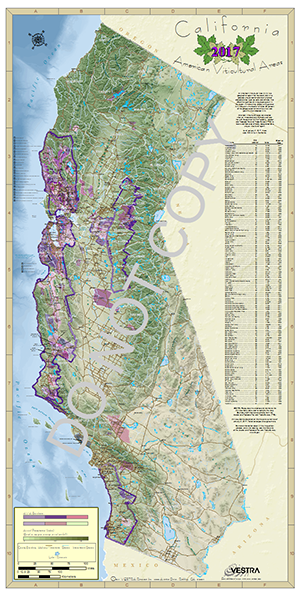
- California AVA map:
- Establishment of the 29,369-acre Lamorinda AVA in Contra Costa County
- Expansion of the Sta. Rita Hills AVA in Santa Barbara County
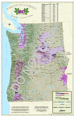
- Oregon/Washington AVA map:
- Establishment of 306,650-acre Lewis-Clark Valley AVA in Washington
- Realignment of the Columbia Valley AVA in Washington
- Expansion of the Willamette Valley AVA in Oregon
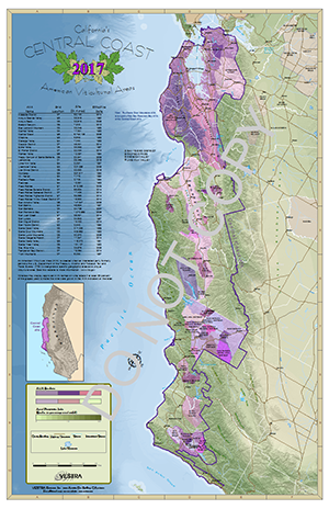
- Central Coast AVA map:
- Establishment of the 29,369-acre Lamorinda AVA in Contra Costa County
- Expansion of the Sta. Rita Hills AVA in Santa Barbara County
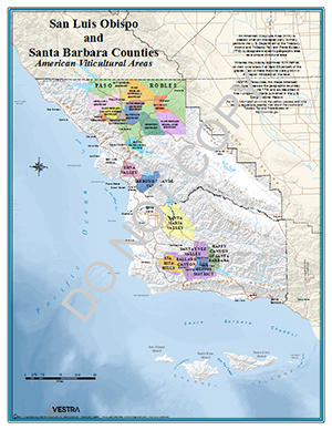
- Santa Barbara/San Luis Obispo Counties AVA map:
- Expansion of the Sta. Rita Hills AVA in Santa Barbara County
Visit the AVA (Viticultural) maps page, or call us for more information or to place an order.
VESTRA also creates custom maps to your specifications. Give us a call to discuss your design and get a quote.